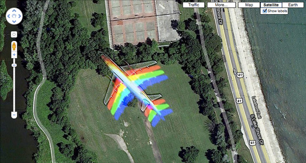
When a Plane Flies Through a Google Maps Satellite Image
Turns out this happens fairly frequently around airports. It also turns out you can do some math and figure out the shutter speed on the satellite.
When a Plane Flies Through a Google Maps Satellite Image
Turns out this happens fairly frequently around airports. It also turns out you can do some math and figure out the shutter speed on the satellite.